
In 2007, I went to the Mayo Clinic in Rochester, MN for a 2 week internship. During the intermediate weekend, I rented a car and took a road trip to explore the state. I was all by myself and I stopped and explored exactly as I pleased.

I knew at the time that I had a great time on the trip, but over the years I've realized that it really marked a turning point in how I look at travel, and how I plan (or more likely don't plan) a trip. At the time, I was really working on my photography, and not quite as much on my scrapbooking. I made one layout with my favorite pictures from the trip and hardly any journaling. While working on MOC for The Lilypad, I found some of the post cards that I bought during the trip and realized that I had forgotten tons of the details. Not wanting to loose any more, I set out to reconstruct the trip with my good friend Google.

Everybody knows that Google is a great tool for everyday research, but it can also be an excellent memory keeping (or recovery) tool. I started a Google Map for the trip, and started by marking the stops that could remember.

- Rochester, MN
- International Falls
- Voyageur National Park
- Duluth, MN
- Mall of America
All you have to do is type in the name of the place into the search bar in the map, and it will come up with a geotag. If you click on the geotag, you'll get a menu that has save to map as one of the options. You can save it to a map you already have started, or make a new one. In this case, I made a map that I named Minnesota.
Next, I added the locations from the post cards I found. I learned a lot about the Voyageurs from two tours that I took: one at Voyageur National Park and another at a Trading Post I stumbled upon along the way. I found the location of the trading post from the post card I bought there. I also had a post card from Soudan Mine which is an old coal mine and museum that they give tours of. As I added each of those to the map, I also bookmarked their websites (in a Minnesota bookmarks folder) so that I could pull some information from them for my journaling.
That was all the information that I had right in front of me, so it was time for a little bit of detective work. I knew that I stopped at a restaurant for breakfast near a photo op of a Walleye with a cowboy hat you can sit on. I googled Walleye photo op and clicked on images, and found my fish, and it's location, which allowed me to find my restaurant.
Looking at the map now, it was easy to trace the route that I drove, which helped to narrow things down. I had a strong memory of driving over a large hill to and seeing Lake Superior come into view. I knew that it was late in the day at that point, and I had to find a campground nearby. I knew that the site I found was quite a ways down several dirt roads, and that I had a hike in spot.
 I googled hike in camping sites on the Minnesota map zoomed in to where my route intersected with Lake Superior, and I found my camp ground (and even the specific site that I stayed in).
In the morning, after I packed up my tent, I started driving and found a pie restaurant, which was completely irresistible, so that was breakfast (and some left overs for lunch). I knew the next city I headed for was Duluth, so I googled pie restaurant on the main highway between my campground and Duluth and hit images again, and there was a picture of my pie restaurant. Apparently it's more well known than I realized.
I really didn't stay very long in Duluth because it was early on a Sunday morning, and nothing was open. If I stayed late enough for the city to start coming to life I would have to forego the Mall of America...nothin' doin'.
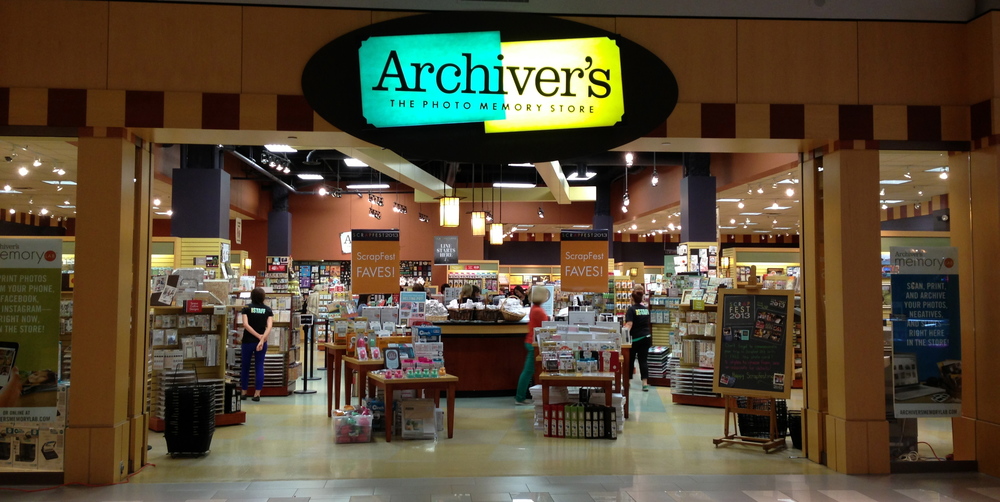
I drove pretty much straight to MOA from Duluth, but I didn't have very much time there. I can't remember why, though. Wait! It's coming to me now. Archiver's. Before that day, I'd never been to an LSS before, much less the scrapbooking Mecca that was Archiver's. I spent a lot of time in there. I'm not sure how much, but I know that I had to practically run to see much of anything else, and I didn't go on any of the rides. MOA is a major tourist attraction, so it's pretty easy to find out information about it. I know I went to the Lake Wobegon store to get a mug for my Grandma and a post card for myself. I love buying post cards for myself when I'm on a trip. They often have photos of views I've seen but don't have the skill to capture and they're inexpensive, but what's better than either of those is all the information on the back of the card. The only reason I was able to track down Soudan Mine as part of this trip's itinerary was because of the information from a post card I bought. It would also have been pretty difficult to find my route without the post cards I'd picked up along the way.
One last tip, that I didn't have a place to fit in anywhere else, is that you can also use historical events as a guide to figure out the dates. Just a couple of days after this trip was when the horrible bridge collapse took place right along my route. Sometimes it can be a big event that can help: I know that I was in Rome the day after the subway bombing in London in 2005 because I read about it in a newspaper I saw near St. Peter's square. Other times it's something ridiculously small: I was in Wells, Maine eating at the counter at the Maine Diner the day the news broke about a major scandal in Kennebunk involving a Zumba instructor. Each of these things are in the public sphere, and so they are easy to look up to find out the dates and locations. More information will often trigger forgotten memories: like the name of the Maine Diner, which I had forgotten until I put this post together.
No comments:
Post a Comment